Summer Travel Map

Monday, June 18, 2012

June 12-18: Escapees Timber Valley Park


June 18, 2012
Sutherlin, Oregon

We continued our meandering through Southern Oregon with a week’s stay at the Timber Valley Park in Sutherlin, Oregon.  It was an easy drive up I-5 from our last stop.  


This park is a coop, owned by the lot holders and associated with the Escapees travel group.  As members of Escapees, we can stay for limited periods in these coop parks at really advantageous rates.  Very good for us retirees!

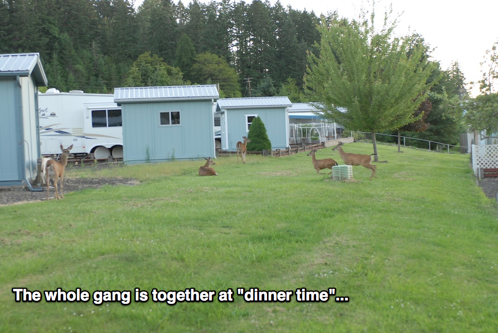
The sites are quite large by RV park standards and each has a small concrete pad and a storage shed (for use by the leaseholder, of course).  We were able to deploy the dog pen and our chairs for afternoon relaxation and wildlife viewing.  Yes, the wildlife actually comes to you!  There’s a small herd of deer that live on the property and wander through, usually in the mornings and evenings.  I think they have “special” lots that they visit, just to torture the occupants (there were several residents who seems to always be chasing the deer away, probably to protect their investment in vegetation).  There are also some rabbits that are especially large, almost as big as Merlin and Maya Lynn.


There wasn’t access to a walking trail here, but I was able to continue my 5-mile walk regimen by walking through the “downtown” area (using that term loosely, as it’s a pretty small town), down to the I-5 interchange, and back.  The weather’s remained mostly nice, although I did get sprinkled on a few times.  That’s what rain gear is for!

We didn’t “do” as much this past week, for a couple of reasons.  First, there’s not as much to do in this area but, second and probably more important, it’s nice to chill and catch up some times.  In this case, I caught up on finances, Geri caught up on laundry, and we had a few nice dinners, including another pork tenderloin with roasted potatoes and a rack of lamb with mushroom risotto.  Yes, we eat well no matter where we are!

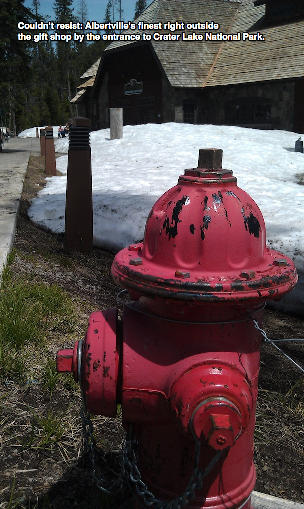
We did make one day trip, south to Roseburg and then east along OR-138 following the Umpqua River.  The Umpqua and Rogue rivers both have headwaters near Crater Lake toward the center of the state and flow to the Pacific.  The Rogue ends in Gold Beach and the Umpqua near Reedsport.  We’ll pass by/through both places on our way south in the fall.  In any event, we saw lots of rapids along the upper Umpqua but not really the waterfalls I was looking for.  No matter; we had a good day and the pups enjoyed the ride in the Rover.  


There are a few wineries in the Umpqua Valley and we did attempt a couple of stops on the way home.  One was having a huge event and was too crowded and the other apparently changed hands and, hence, names, and was impossible to find.  I figured that was life’s way of telling us “not today on the wine tasting, fella”, so we just continued on our way.  Maybe “next time”...

Monday, June 11, 2012

June 5-11: Valley of the Rogue State Park


June 11, 2012
Rogue River, Oregon

We had a nice week at this Oregon state park, right along the Rogue River.  It’s not often that we stay at state parks, mostly because so many were constructed before motorhomes, much less ones of our size.  But, there seems to be a growing trend toward modernization that hasn’t been completely sidelined by recovery economics and we were happy to have a nice long back-in site with water and 50 Amp electric for the week.  The park has a mixture of full-hookup and water/electric sites (with a few tenting sites as well), but I selected ours based on using Google Earth to see if I could guess which sites would be “satellite friendly”.  I guess that means that TV is more important than a sewer connection.  Who knew?

The park is fairly large and, even though it’s sandwiched between I-5 and the river, it was relatively peaceful.  We had a visit from a lone deer that was grazing in the pasture right behind us several nights, so were able to check the “wildlife” box.  Actually, I watched a bald eagle fishing in the river one morning as well, but I was too far away to get a good picture with the phone.


The park also features a set of nice, paved walking trails along the river, stretching all the way to the little burg of Rogue River downstream.  I found that a walk to there, turning around at the Rogue River Bridge (actually at the loo in the city park by the bridge) gave me just over the 5-mile brisk walk I’ve been aiming for on the exercise front.

We did make a few side trips this week.  Since Medford is the largest “population zone” nearby, we used that as our shopping base as needed.  Costco, Walmart, Freddie (Fred Meyer) - all the biggies.  We picked up a camp oven that we’ve been eyeing, saving almost 10% in tax-free Oregon, so that led to a Pork Tenderloin with Mushroom Risotto dinner (Mmmm).  We also visited the Rogue Creamery, specialists in Oregon Blue Cheese (yes, we tasted and loaded up) and found, much to our surprise, a wine tasting room right next door.  Bonus!


Keeping an eye on the weather, we made a trip down the Redwood Highway (aka US-199) from Grants Pass to Crescent City, just across the border into California.  It’s quite a scenic drive, and we were able to park and have lunch on a bluff overlooking the Pacific.  It was pretty breezy and a bit cool, but there were still a few people out on the beach and feeding the seagulls.  Crescent City is right on US-101 and we’ve passed through several times over the years but never stopped.  We might check it out for a few days on our way south later in the year.  On the way back, we made several stops in the Redwoods, and Geri checked out one of the Burl Wood shops.


I mentioned watching the weather because our other side trip was up to Crater Lake.  The day I’d planned to go there it was snowing, so we decided on the ocean instead.  But, today the forecast was for clearing and warmer temperatures so we headed off, backroading (is that a word?) across OR-234 to OR-62, one of the main access roads to Crater Lake.  We’ve been there before in June, about 20 years ago on one of our RV rental vacations, and found similar conditions: snow melt incomplete and several sections of the Park not yet open for the season.  But, that wasn’t a problem, as we had some fine weather for pictures and a picnic lunch.  We definitely got our “snow fix”, with drifts still quite high in some places.  The altitude was getting to Geri, so we limited our time at the top.  I have a few pictures that I’ll try to work into composite panoramas when I have the time and inclination to play around with Photoshop.


OR-62 follows the upper Rogue River, so we had a chance to stop for some pictures on the return trip as well.  With snow still melting at the upper elevations, water flow was still pretty strong.  Several parts of the Rouge River National Forest were identified as off limits, though, or we’d have spent more time exploring the area.


Monday, June 4, 2012

June 1-4: Off the grid along the Klamath River

June 4, 2012
Blue Heron RV Park, Hornbrook, California

OK, we’re not really “off the grid” since we’re at a nice RV Park with full hookups, but having no cell phone service and very spotty Internet access makes it seem that way!  It’s probably therapeutic, though...

Since we’re not in any big hurry on our way north, I decided to book us into the Blue Heron RV Park for a few days.  Only about 20 miles north of Yreka, we were able to take our time getting ready and still be parked before Noon.  Our pull-in site puts us facing the water.  The namesake blue heron was fishing along the water’s edge as we set up, and we saw a few skiffs of fishermen and their guides float past.  Excellent!


This park costs a little more (OK, a lot more) than we like to pay, but their pricing scheme gives one night free for every three paid.  OK, it’s still more than we like to pay, but here we are.  It’s a well laid out park right along the Klamath River, with large sites, concrete pads, and lots of grass all around.  And, we found it almost empty with only five other rigs parked.  And, two of those belong to the owners and two more are housing people who work here.  So, the owners have more money than they know what to do with, they need a tax write-off, they wanted a place for their two hounds and colt to roam, and/or there are some really busy times of the year that we missed.  Everyone is super friendly, so it’s a generally pleasant place.


After checking in, we walked the pups around the grounds and settled in for a relaxing afternoon.  Being about 6.5 miles off the Interstate, we’re out of cell phone range but their Wi-Fi was working so we were able to communicate with the outside world.  As the weekend progressed, connectivity diminished to the point of failure, but we survived.

In addition to the RV facilities, they have an on-site restaurant where we ate for Friday dinner (not bad prime rib) and Sunday brunch.  It wasn’t any busier than the RV Park.  We asked about the lack of people and were told that things get really busy when the salmon are running later in the summer, and during fall hunting season.  I suppose, but it seems like most people looking for a fishing or hunting “camp” would be expecting a more rustic environment.  Whatever; we decided to get over our curiosity about the business model and enjoy our stay!

On Saturday, the weather was still beautiful and we took a ride further up-river.  We soon came to the Iron Gate Hydroelectric Dam and, behind it, Iron Gate Lake Recreation Area.  This whole section of the Klamath River is managed by the local power utility and there are seven hydroelectric power plants between here and Klamath Falls in southern Oregon.  Iron Gate is the furthest down-river and has a 1.7 megawatt generation capacity. 


Iron Gate Lake is several miles long and has quite a few access and camping points along the shoreline.  We took a ride as far as the road seemed to go and saw quite a few groups camping and fishing.  We also passed a fish hatchery that generates over 6 million small fry each year, so fishing is probably good at times.  This kind of environment attracts birds of prey as well, and we saw several large nests mounted on top of utility poles along the road.

In addition to the RV Park and restaurant, the development includes plans for a number of cottages built into the hillside overlooking the river.  There’s a private road in place even though further development seems to be “on hold” for now.  I walked up to the top, about 3.5 miles round-trip, and was able to get a nice view of the surrounding area.  It looks like they have some of the utilities in place, and even have a flagpole mounted right near the top. 


Sunday, I took a walk up to the dam, also about 3.5 miles round-trip, but the weather started to turn and I was soon returning in a light rain.  Even though I wasn’t prepared for rain, I didn’t melt.  As the day progressed, it turned cooler and the rain was pretty steady but light until Tuesday morning when the showers turned spotty but the wind really picked up.  No matter; we can’t really complain because we haven’t seen much rain at all this year.

This afternoon, we’ve relaxed, watched some Food Network and Cooking Channel, and Geri’s finished up laundry, as we won’t have full hookups at our next stop.  Tomorrow, we’ll finally make it to southern Oregon.

Oh, and just for luck, I found Geri a 4-leaf clover while out “exercising” the pups...

Thursday, May 31, 2012

May 25-31: Yreka, California, including a return visit to Mount Shasta


May 31, 2012
Yreka RV Park, Yreka, CA
Wow; staying in one place a whole week!  What a deal.  I selected Yreka and this specific RV park based on working backward on the calendar, then the map.  One of the few pre-planned dates on our schedule this summer is a stop at North Bend, Oregon, for a Rally starting June 19th.  Working backwards in time and along our route, this seemed like a good place to “drop anchor” for a week.  I was hoping to get far enough north and up in elevation to get some cooler weather, plus see if we could check out to Mount Shasta area.  It pretty much worked out as planned.

Yreka (rhymes with Eureka, with a “why” instead of “you”), like many towns in this part of the country, was founded on gold mining, built up quickly, and went bust just as fast.  How it managed to hang on is anyone’s guess, although proximity to “Historic Route 99” and now I-5 probably has a lot to do with it.  There’s not a lot to do and that fit our travel plan perfectly.  I used the time to catch up on a few maintenance projects, Geri did some laundry, and I caught up on finances.  We had good TV reception and, although the Park’s free Wi-Fi service was only operational some of the time, we were able to supplement it with our Verizon portable hotspot so all was good.

We did take a ride out to the south and east to get closer to Mount Shasta, and ended up finding a nice picnic spot along Lake Shastina (a community reservoir, similar to Brite Lake we’d found in Tehachapi a few weeks ago) as a bonus.  We’ve been through this area several times on I-5 over the past decade but haven’t stopped as we’ve always been on the way to somewhere else.  We did stop here years ago, on our second “RV Rental Vacation”, which I’m guessing was 1994.  We flew into Portland and picked up the rental, then traveled south before cutting inland near Mount Shasta, picking up US-97 back north to Crater Lake.  We both remember that, because the snow drifts were still taller than the rental RV even though it was some time in June.  But, I digress...


We picked a very nice day for a drive, heading east from Yreka and using back roads to  head down toward the mountain.  At 14,162 feet in elevation, it’s ranked 49th in the US, just behind Mount Rainier (which we’ll see later in June when we’re up in the Seattle area).  In addition to the mountain, we made a short stop at Grass Lake, which is essentially a very large marsh, before finding our lunch spot.  All in all, it was a nice side trip.


Although the weather was generally nice, we did have a couple of days that required use of the air conditioning but nothing severe.  It was also pretty breezy the whole week, which made awning use hit-or-miss and did cause some issues for the barbecue grill.  In spite of that, we were able to spend most afternoons outside; I put out the pens for the pups to join us.  We did use the grill several times, doing a nice “steak & bake” with grilled ears of corn, and making a marinated tri-tip roast that came out very tasty.  As always, we continue to eat well while on the road.

While we were in Yreka I was able to keep up my walking regimen, trekking down the hill from the RV park and walking along the “main drag” in town to get the right distance.  I was able to put in 3.5 to 5.5 mile walks, even using one jaunt to go to the Post Office to pick up our General Delivery mail.  Always on the lookout, I was able to spot one of “Albertville’s finest” along the historic downtown street.  I also made a quick stop at the Chinese Cemetery (it was right on my walking route)...